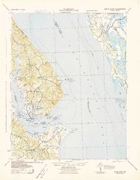
1942 Map of Drum Point
USGS Topo · Published 1942About this map
The Chesapeake Bay dominates this mid-century survey, dividing the peninsula of Calvert County from the low-lying wetlands of Dorchester County. On the western shore, the deep waters of the Patuxent River meet the bay at Solomons, where Spencers Wharf and Millstone Landing indicate a busy maritime corridor. Small inland settlements like Lusby, Bertha, and Jarboesville are connected by early road networks, while the shoreline is dotted with critical navigation landmarks including the light at Cove Point.
Find a feature on this map
62 named features on this map. Tap any name to fly to it.
Don’t see what you’re looking for? This feature index may not catch every label — zoom into the map to look around manually.
Map Details
Editions of this 1942 Drum Point Map
This is the sole edition of this map. No revisions or reprints were ever made.
Other maps of this area

1892 · Leonardtown
USGS Topo · 1:62,500

1892 · Drum Point
USGS Topo · 1:62,500

1892 · Prince Frederick
USGS Topo · 1:62,500

1892 · Piney Point
USGS Topo · 1:62,500

1893 · Sharps Island
USGS Topo · 1:62,500

1894 · Piney Point
USGS Topo · 1:62,500

1894 · Point Lookout
USGS Topo · 1:62,500

1895 · Prince Frederick
USGS Topo · 1:62,500

1895 · Leonardtown
USGS Topo · 1:62,500

1895 · Nomini
USGS Topo · 1:125,000