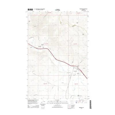
2014 Map of Drummond
USGS Topo · Published 2014About this map
The Clark Fork river valley serves as the central corridor for this 2014 landscape, where the confluence with Flint Creek anchors the settlement of Drummond. The town is well-defined by its transportation links, including the Drummond Bridge and proximity to the Garnet Range to the north. Smaller named locales such as Ozan, Bradman, and New Chicago are situated along the valley floor, reflecting the historical distribution of ranching and early commerce in Granite County. To the south, the Valley Cem near New Chicago provides a significant point of interest for genealogists tracing local families. The terrain is marked by numerous drainages like Rattler Gulch and Garden Gulch, while high points such as King Mtn overlook the winding W Mullan Trl, a route following the legacy of early territorial travel.
Find a feature on this map
45 named features on this map. Tap any name to fly to it.
Don’t see what you’re looking for? This feature index may not catch every label — zoom into the map to look around manually.
Map Details
Editions of this 2014 Drummond Map
This is the sole edition of this map. No revisions or reprints were ever made.
Other maps of this area

1919 · Drummond
USGS Topo · 1:125,000

1921 · Drummond
USGS Topo · 1:125,000

1947 · Butte
USGS Topo · 1:250,000

1958 · Butte
USGS Topo · 1:250,000

1958 · Drummond
USGS Topo · 1:62,500

1959 · Bearmouth
USGS Topo · 1:62,500

1960 · Butte
USGS Topo · 1:250,000

1962 · Butte
USGS Topo · 1:250,000
1965 · Chimney Lakes
USGS Topo · 1:24,000

1965 · Wild Horse Parks
USGS Topo · 1:24,000