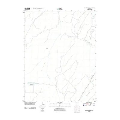
2010 Map of Dry Creek Basin
USGS Topo · Published 2010About this map
Dry Creek Basin and the surrounding high desert terrain in Montrose County are defined by an intricate network of irrigation and water management features. The landscape is marked by the presence of Olathe Reservoir Number 1 and Olathe Reservoir Number 2, which, along with Citizens Dam, underscore the critical role of water storage in this arid region. The distribution of water is further illustrated by the Dry Creek Ditch, West Canal, and the C O Lateral, showing how early 21st-century engineering adapted the natural drainage of Dry Creek and Piney Creek for local use. Natural landmarks such as Temple Park and the deep cuts of Linscott Canyon and Lindsey Canyon break the basin floor, while the Dry Creek Prospect indicates a history of mineral exploration in the western reaches of the quadrangle.
Find a feature on this map
21 named features on this map. Tap any name to fly to it.
Don’t see what you’re looking for? This feature index may not catch every label — zoom into the map to look around manually.
Map Details
Editions of this 2010 Dry Creek Basin Map
This is the sole edition of this map. No revisions or reprints were ever made.
Other maps of this area

1909 · Montrose
USGS Topo · 1:125,000

1911 · Montrose
USGS Topo · 1:125,000

1955 · Olathe
USGS Topo · 1:24,000

1956 · Montrose
USGS Topo · 1:250,000

1956 · Moab
USGS Topo · 1:250,000

1959 · Moab
USGS Topo · 1:250,000

1959 · Montrose
USGS Topo · 1:250,000

1960 · Montrose
USGS Topo · 1:250,000

1960 · Moab
USGS Topo · 1:250,000

1962 · Moab
USGS Topo · 1:250,000