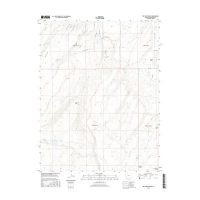
2016 Map of Dry Creek Basin
USGS Topo · Published 2016About this map
The Fingers and Coyote Ridge define the complex topography of this Montrose County landscape, where deep drainages like Linscott Canyon cut through the high ground. The western portion of the sheet is dominated by the Dry Creek Basin, a significant topographical depression fed by the W Fork Dry Cr and E Fork Dry Cr. The irrigation infrastructure essential to this arid region is visible through features like the Dry Cr Ditch, W Canal, and the two Olathe Reservoir basins.
Find a feature on this map
38 named features on this map. Tap any name to fly to it.
Don’t see what you’re looking for? This feature index may not catch every label — zoom into the map to look around manually.
Map Details
Editions of this 2016 Dry Creek Basin Map
This is the sole edition of this map. No revisions or reprints were ever made.
Other maps of this area

1909 · Montrose
USGS Topo · 1:125,000

1911 · Montrose
USGS Topo · 1:125,000

1955 · Olathe
USGS Topo · 1:24,000

1956 · Montrose
USGS Topo · 1:250,000

1956 · Moab
USGS Topo · 1:250,000

1959 · Moab
USGS Topo · 1:250,000

1959 · Montrose
USGS Topo · 1:250,000

1960 · Montrose
USGS Topo · 1:250,000

1960 · Moab
USGS Topo · 1:250,000

1962 · Moab
USGS Topo · 1:250,000