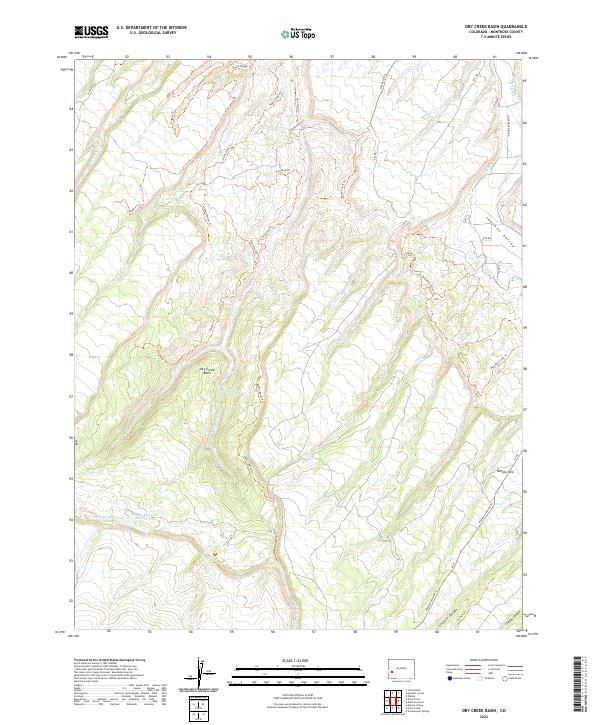
2022 Map of Dry Creek Basin
USGS Topo · Published 2022About this map
Dry Creek Basin and the adjacent Shavano Valley anchor this landscape in Montrose County, where high-desert terrain meets essential water infrastructure. The map illustrates a complex network of irrigation and water storage, notably featuring the Olathe Reservoir Number 1 and Olathe Reservoir Number Two in the south, alongside the Dry Cr Ditch and the W Canal. These features highlight the region's historical reliance on managed water systems to support the arid highlands.
Find a feature on this map
40 named features on this map. Tap any name to fly to it.
Don’t see what you’re looking for? This feature index may not catch every label — zoom into the map to look around manually.
Map Details
Editions of this 2022 Dry Creek Basin Map
This is the sole edition of this map. No revisions or reprints were ever made.
Other maps of this area

1909 · Montrose
USGS Topo · 1:125,000

1911 · Montrose
USGS Topo · 1:125,000

1955 · Olathe
USGS Topo · 1:24,000

1956 · Montrose
USGS Topo · 1:250,000

1956 · Moab
USGS Topo · 1:250,000

1959 · Moab
USGS Topo · 1:250,000

1959 · Montrose
USGS Topo · 1:250,000

1960 · Montrose
USGS Topo · 1:250,000

1960 · Moab
USGS Topo · 1:250,000

1962 · Moab
USGS Topo · 1:250,000