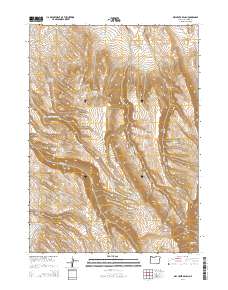
2014 Map of Dry Creek Bench
USGS Topo · Published 2014About this map
Dry Creek Bench rises as a prominent landmark in this southeastern corner of Malheur County, where a complex network of seasonal water sources and reservoirs supports the high-desert livestock economy. The landscape is defined by the drainages of Twelvemile Cr and Little Antelope Cr, punctuated by man-made catchments such as Frenchys Reservoir and the Miracle Reservoirs. These features, along with numerous named springs like Cherry Spring and Tin Trough Spring, reveal the essential role of water management in this arid grazing land. The presence of the Whitehorse Cutoff in the northeastern corner suggests the historical transit routes used to navigate this remote terrain, connecting isolated ranching outposts across the high plateau. Deep ravines such as Dry Gulch and the drainage of Fish Cr carve through the rising elevation, illustrating the erosive power of seasonal runoff in the Oregon outback.
Find a feature on this map
30 named features on this map. Tap any name to fly to it.
Don’t see what you’re looking for? This feature index may not catch every label — zoom into the map to look around manually.
Map Details
Editions of this 2014 Dry Creek Bench Map
This is the sole edition of this map. No revisions or reprints were ever made.
Other maps of this area

1955 · Jordan Valley
USGS Topo · 1:250,000

1955 · Adel
USGS Topo · 1:250,000

1957 · Adel
USGS Topo · 1:250,000

1957 · Jordan Valley
USGS Topo · 1:250,000

1958 · Adel
USGS Topo · 1:250,000

1958 · Jordan Valley
USGS Topo · 1:250,000

1962 · Adel
USGS Topo · 1:250,000
1981 · Twelvemile Ridge
USGS Topo · 1:24,000
1981 · Little Whitehorse Creek
USGS Topo · 1:24,000
1981 · Dry Creek Bench
USGS Topo · 1:24,000