1981 Map of Twelvemile Ridge
USGS Topo · Published 1981About this map
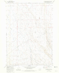
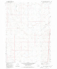
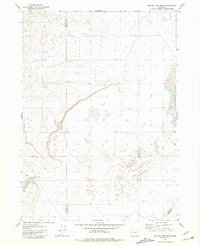
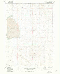
Twelvmile Ranch sits at the heart of this high-desert landscape in Malheur County, where the ranching economy and rugged terrain dictate the few human imprints on the land. Surveyed in the mid-1970s and published by the Geological Survey in 1981, this map captures the sheer verticality of Twelvemile Ridge and the prominent height of Three Man Butte. Water is the primary sculptor of this environment, with the drainage systems of Duck Creek, Twelvemile Creek, and Dry Creek cutting through the upland. The Twelvemile Grade represents the primary logistical artery through the hills, while the inclusion of a Borrow Pit points to the practical infrastructure required to maintain routes in such a remote corner of eastern Oregon.
Find a feature on this map
11 named features on this map. Tap any name to fly to it.
Don’t see what you’re looking for? This feature index may not catch every label — zoom into the map to look around manually.
Map Details
Editions of this 1981 Twelvemile Ridge Map
This is the sole edition of this map. No revisions or reprints were ever made.
Other maps of this area

1955 · Jordan Valley
USGS Topo · 1:250,000

1955 · Adel
USGS Topo · 1:250,000

1957 · Adel
USGS Topo · 1:250,000

1957 · Jordan Valley
USGS Topo · 1:250,000

1958 · Adel
USGS Topo · 1:250,000

1958 · Jordan Valley
USGS Topo · 1:250,000

1962 · Adel
USGS Topo · 1:250,000
1980 · Rome State Airport
USGS Topo · 1:24,000
1981 · Coyote Lake West
USGS Topo · 1:24,000
1981 · Coyote Lake East
USGS Topo · 1:24,000