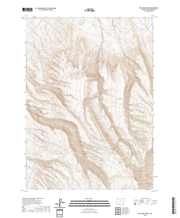
2023 Map of Dry Creek Bench
USGS Topo · Published 2023About this map
Twelvemile Reservoir and Miracle Reservoir anchor a landscape defined by seasonal water management and rugged drainage systems in this Malheur County corridor. The topographic data reveals a complex network of springs, such as Cherry Spring and Tin Trough Spring, which were vital for livestock and early ranching operations in this high-desert environment. The prominent Dry Creek Bench overlook provides a clear view of the surrounding canyons where Little Antelope Creek and Fish Creek carve through the terrain. Transportation in the area is largely defined by legacy routes like Echave Ranch Rd and Mud Spring Rd, which connect isolated water sources like Frenchys Reservoir and Fish Reservoir. This map documents a region where the placement of every spring and reservoir tells the story of human adaptation to an arid climate.
Find a feature on this map
29 named features on this map. Tap any name to fly to it.
Don’t see what you’re looking for? This feature index may not catch every label — zoom into the map to look around manually.
Map Details
Editions of this 2023 Dry Creek Bench Map
This is the sole edition of this map. No revisions or reprints were ever made.
Other maps of this area

1955 · Jordan Valley
USGS Topo · 1:250,000

1955 · Adel
USGS Topo · 1:250,000

1957 · Adel
USGS Topo · 1:250,000

1957 · Jordan Valley
USGS Topo · 1:250,000

1958 · Adel
USGS Topo · 1:250,000

1958 · Jordan Valley
USGS Topo · 1:250,000

1962 · Adel
USGS Topo · 1:250,000
1981 · Twelvemile Ridge
USGS Topo · 1:24,000
1981 · Little Whitehorse Creek
USGS Topo · 1:24,000
1981 · Dry Creek Bench
USGS Topo · 1:24,000