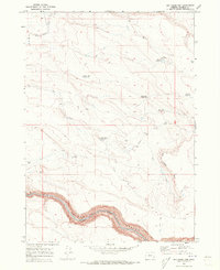
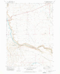
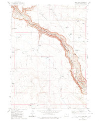
1969 Map of Dry Creek Rim
USGS Topo · Published 1973About this map
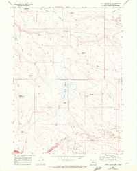
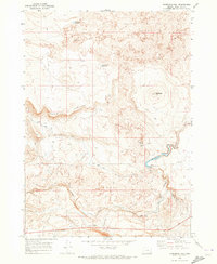
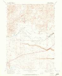
The Owyhee River carves a deep path through the high desert of Malheur County, anchored by the steep walls of the Owyhee Canyon. This 1969 field-checked survey reveals an arid landscape managed through a complex network of water infrastructure, featuring numerous named catchments such as Eiguren Reservoir, Pinto Horse Reservoir, and Fretwell Reservoir. These small reservoirs, scattered across the plateau, suggest the vital importance of seasonal water management for ranching in this corner of eastern Oregon.
Find a feature on this map
17 named features on this map. Tap any name to fly to it.
Don’t see what you’re looking for? This feature index may not catch every label — zoom into the map to look around manually.
Map Details
Editions of this 1969 Dry Creek Rim Map
This is the sole edition of this map. No revisions or reprints were ever made.
Other maps of this area

1955 · Jordan Valley
USGS Topo · 1:250,000

1957 · Jordan Valley
USGS Topo · 1:250,000

1958 · Jordan Valley
USGS Topo · 1:250,000
1969 · Little Grassy Mountain
USGS Topo · 1:24,000
1969 · Threemile Hill
USGS Topo · 1:24,000
1969 · Danner
USGS Topo · 1:24,000
1972 · Scott Reservoir
USGS Topo · 1:24,000
1972 · Arock
USGS Topo · 1:24,000
1979 · Rockhouse Reservoir
USGS Topo · 1:24,000
1980 · Skull Creek
USGS Topo · 1:24,000