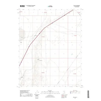
2018 Map of Dry Lake
USGS Topo · Published 2018About this map
The Dry Lake Range and the expanse of the Mojave Desert dominate this Clark County landscape, where the transportation network follows the basin floor. The tiny settlement of Dry Lake sits along a major transit corridor, while Garnet anchors the southwestern portion of the sheet. The terrain is characterized by the flat Dry Lake Valley and the drainage of California Wash, which cuts through the southeastern corner. This modern survey reflects the enduring influence of historic travel routes, featuring the Old Spanish Trail Rd and the Valley of Fire Hwy. These roads trace the same paths across the desert floor that have connected this region for generations, from early travelers to modern interstate commerce. The map provides a clear view of the township and range system, including t17s r64e and t18s r65e, which define the cadastral history of the area.
Find a feature on this map
17 named features on this map. Tap any name to fly to it.
Don’t see what you’re looking for? This feature index may not catch every label — zoom into the map to look around manually.
Map Details
Editions of this 2018 Dry Lake Map
This is the sole edition of this map. No revisions or reprints were ever made.
Other maps of this area

1886 · Saint Thomas
USGS Topo · 1:250,000

1893 · Saint Thomas
USGS Topo · 1:250,000

1926 · Boulder Canyon
USGS Topo · 1:96,000

1952 · Dry Lake
USGS Topo · 1:62,500

1953 · Muddy Peak
USGS Topo · 1:62,500

1954 · Las Vegas
USGS Topo · 1:250,000

1957 · Las Vegas
USGS Topo · 1:250,000

1958 · Arrow Canyon
USGS Topo · 1:62,500

1958 · Moapa
USGS Topo · 1:62,500

1959 · Las Vegas
USGS Topo · 1:250,000