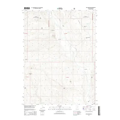
2014 Map of Dry Mountain
USGS Topo · Published 2014About this map
Ashley National Forest covers the northern half of this terrain, where high-elevation landmarks like Mount Albert and Dry Mtn define the drainage patterns of the Uinta Basin. The area is characterized by a network of seasonal water sources and named high-country passes, including Mountain Sheep Pass and Farm Creek Pass. These routes provided essential passage through the steep topography for early travelers and livestock herders.
Find a feature on this map
33 named features on this map. Tap any name to fly to it.
Don’t see what you’re looking for? This feature index may not catch every label — zoom into the map to look around manually.
Map Details
Editions of this 2014 Dry Mountain Map
This is the sole edition of this map. No revisions or reprints were ever made.
Other maps of this area

1885 · Uinta
USGS Topo · 1:250,000

1901 · Hayden Peak
USGS Topo · 1:125,000

1903 · Hayden Peak
USGS Topo · 1:125,000

1905 · Gilbert Peak
USGS Topo · 1:125,000

1906 · Gilbert Peak
USGS Topo · 1:125,000

1939 · Duchesne
USGS Topo · 1:125,000

1954 · Salt Lake City
USGS Topo · 1:250,000

1958 · Salt Lake City
USGS Topo · 1:250,000

1960 · Salt Lake City
USGS Topo · 1:250,000

1962 · Blacktail Mtn
USGS Topo · 1:24,000