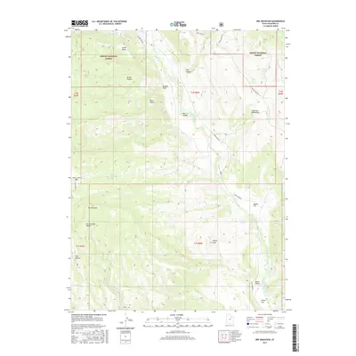
2017 Map of Dry Mountain
USGS Topo · Published 2017About this map
Ashley National Forest dominates this high-altitude landscape in the Uinta Basin region, where the terrain transitions through a series of significant peaks and drainage basins. High points like Dry Mountain and Mount Albert anchor the topography, while the hydrological network is defined by the south-flowing Rock Creek and Pigeon Water Cr. The map reveals a complex system of livestock-era landmarks and water sources, including Birch Spring, Gooseberry Spring, and Pigeon Water Spring. High mountain passes such as Mountain Sheep Pass and Farm Creek Pass indicate the historical routes used to navigate this section of the Duchesne County backcountry. The presence of several distinct high-meadow areas, like Daniel Flat, Sadies Flat, and Knolly Flats, suggests the traditional importance of this area for seasonal grazing and high-country navigation prior to modern road developments like the McAfee Bypass.
Find a feature on this map
35 named features on this map. Tap any name to fly to it.
Don’t see what you’re looking for? This feature index may not catch every label — zoom into the map to look around manually.
Map Details
Editions of this 2017 Dry Mountain Map
This is the sole edition of this map. No revisions or reprints were ever made.
Other maps of this area

1885 · Uinta
USGS Topo · 1:250,000

1901 · Hayden Peak
USGS Topo · 1:125,000

1903 · Hayden Peak
USGS Topo · 1:125,000

1905 · Gilbert Peak
USGS Topo · 1:125,000

1906 · Gilbert Peak
USGS Topo · 1:125,000

1939 · Duchesne
USGS Topo · 1:125,000

1954 · Salt Lake City
USGS Topo · 1:250,000

1958 · Salt Lake City
USGS Topo · 1:250,000

1960 · Salt Lake City
USGS Topo · 1:250,000

1962 · Blacktail Mtn
USGS Topo · 1:24,000