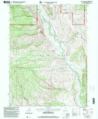
1996 Map of Dry Mountain
USGS Topo · Published 2000About this map
The Uintah and Ouray Indian Reservation boundary cuts across this terrain, marking a distinct division in land management within the Ashley National Forest. This high-altitude landscape is defined by its water sources and drainage patterns, where Rock Creek and Pigeon Water Creek carve through the deep hollows and basins. Human activity is largely centered on resource management and navigation, evidenced by the Indian Ranger Station and a Gaging Station positioned near the headwaters.
Find a feature on this map
31 named features on this map. Tap any name to fly to it.
Don’t see what you’re looking for? This feature index may not catch every label — zoom into the map to look around manually.
Map Details
Editions of this 1996 Dry Mountain Map
This is the sole edition of this map. No revisions or reprints were ever made.
Other maps of this area

1885 · Uinta
USGS Topo · 1:250,000

1901 · Hayden Peak
USGS Topo · 1:125,000

1903 · Hayden Peak
USGS Topo · 1:125,000

1905 · Gilbert Peak
USGS Topo · 1:125,000

1906 · Gilbert Peak
USGS Topo · 1:125,000

1939 · Duchesne
USGS Topo · 1:125,000

1954 · Salt Lake City
USGS Topo · 1:250,000

1958 · Salt Lake City
USGS Topo · 1:250,000

1960 · Salt Lake City
USGS Topo · 1:250,000

1962 · Blacktail Mtn
USGS Topo · 1:24,000