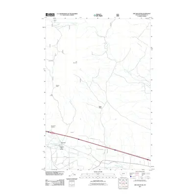
2011 Map of Dry Mountain
USGS Topo · Published 2011About this map
Pipestone Hot Springs and the surrounding high-altitude terrain define this 2011 survey of Jefferson County. The landscape is marked by a legacy of mountain ranching and resource extraction, evidenced by Gillespie Ranch, Caldwell Ranch, and the Easter Lily Mine located near the base of Dry Mountain. A distinct network of water management features, including the Paul-McArthur Ditch Number One and Pipestone Ditch, illustrates the engineering required to support high-desert agriculture and settlement in this part of Montana. Notable geological and recreational landmarks like Ringing Rocks and the Pipestone Campground serve as focal points for local geography, while infrastructure such as the State Highway Department Sandhouse highlights the logistical demands of maintaining routes through the mountain passes. The map traces the transition from traditional homesteads like Tippet Place to more contemporary developments such as McLeod Estates Rd.
Find a feature on this map
29 named features on this map. Tap any name to fly to it.
Don’t see what you’re looking for? This feature index may not catch every label — zoom into the map to look around manually.
Map Details
Editions of this 2011 Dry Mountain Map
This is the sole edition of this map. No revisions or reprints were ever made.
Other maps of this area

1889 · Helena
USGS Topo · 1:250,000

1893 · Helena
USGS Topo · 1:250,000

1893 · Dillon
USGS Topo · 1:250,000

1899 · Boulder
USGS Topo · 1:125,000

1899 · Helena
USGS Topo · 1:250,000

1903 · Helena
USGS Topo · 1:250,000

1947 · Butte
USGS Topo · 1:250,000

1954 · Elk Park
USGS Topo · 1:62,500

1954 · Boulder
USGS Topo · 1:62,500

1955 · Dillon
USGS Topo · 1:250,000