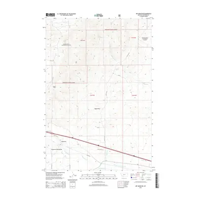
2014 Map of Dry Mountain
USGS Topo · Published 2014About this map
Pipestone Hot Springs and the adjacent settlement of Pipestone anchor the southern portion of this landscape, situated along the complex irrigation network of the Pipestone Ditch and Big Pipestone Cr. The terrain transitions from these water-managed lowlands toward the northern heights of Dry Mtn and the unique geologic formation known as Ringing Rocks. Much of the northern half is defined by the protected lands of the Deerlodge National Forest, where a network of primitive routes like Sheep Camp Rd and Whitetail Rd provide access through the mountain drainages. The map reveals a specific pattern of land use where historic homesteads or rural residences, such as Tippet Place, are situated between the rugged forest boundary and the managed agricultural valley below, which is further supported by the Paul-McArthur Ditch Number One.
Find a feature on this map
30 named features on this map. Tap any name to fly to it.
Don’t see what you’re looking for? This feature index may not catch every label — zoom into the map to look around manually.
Map Details
Editions of this 2014 Dry Mountain Map
This is the sole edition of this map. No revisions or reprints were ever made.
Other maps of this area

1889 · Helena
USGS Topo · 1:250,000

1893 · Helena
USGS Topo · 1:250,000

1893 · Dillon
USGS Topo · 1:250,000

1899 · Boulder
USGS Topo · 1:125,000

1899 · Helena
USGS Topo · 1:250,000

1903 · Helena
USGS Topo · 1:250,000

1947 · Butte
USGS Topo · 1:250,000

1954 · Elk Park
USGS Topo · 1:62,500

1954 · Boulder
USGS Topo · 1:62,500

1955 · Dillon
USGS Topo · 1:250,000