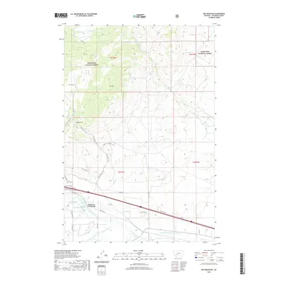
2020 Map of Dry Mountain
USGS Topo · Published 2020About this map
Pipestone Hot Springs and the surrounding high-country terrain of Deerlodge National Forest define this 2020 landscape in Jefferson County. The map provides a detailed view of the regional water management systems, notably the Pipestone Ditch and the Paul-McArthur Ditch Number One, which divert water through the valley floor. Dominating the central topography is Dry Mtn, while the geological curiosity of Ringing Rocks is accessible via an intricate network of specialized paths including the Ringing Rocks Trail and Ringing Clay Connector Trail. Several named springs, such as 02N05W28BBBB01 Spring, are documented near the hot springs complex. The drainage patterns of Big Pipestone Cr and Little Whitetail Cr illustrate the watershed's complexity, serving as a primary reference for the area's modern hydrography and forest access routes.
Find a feature on this map
37 named features on this map. Tap any name to fly to it.
Don’t see what you’re looking for? This feature index may not catch every label — zoom into the map to look around manually.
Map Details
Editions of this 2020 Dry Mountain Map
This is the sole edition of this map. No revisions or reprints were ever made.
Other maps of this area

1889 · Helena
USGS Topo · 1:250,000

1893 · Helena
USGS Topo · 1:250,000

1893 · Dillon
USGS Topo · 1:250,000

1899 · Boulder
USGS Topo · 1:125,000

1899 · Helena
USGS Topo · 1:250,000

1903 · Helena
USGS Topo · 1:250,000

1947 · Butte
USGS Topo · 1:250,000

1954 · Elk Park
USGS Topo · 1:62,500

1954 · Boulder
USGS Topo · 1:62,500

1955 · Dillon
USGS Topo · 1:250,000