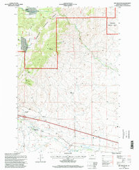
1996 Map of Dry Mountain
USGS Topo · Published 1998About this map
Pipestone Hot Springs and the surrounding high country of the Deerlodge National Forest define this landscape on the eastern slopes of the Continental Divide in the late 1990s. The map illustrates a complex water management and mining history, tracing the Paul-Mc Arthur Ditch No 1 and various pipelines across the terrain. Significant geological and industrial features include the unique Ringing Rocks formation and the Easter Lily Mine, alongside several gravel pits and unspecified mine sites. Remote homesteads and operational outposts like Gillette Ranch, Caldwell Ranch, and the Tippet Place are documented, while the State Highway Department Sandhouse at Pipestone provides evidence of the region's infrastructure maintenance. The drainage network is well-defined by Big Pipestone Creek and Whitetail Creek, showing the natural water flow that historically supported both ranching and mineral extraction.
Find a feature on this map
27 named features on this map. Tap any name to fly to it.
Don’t see what you’re looking for? This feature index may not catch every label — zoom into the map to look around manually.
Map Details
Editions of this 1996 Dry Mountain Map
This is the sole edition of this map. No revisions or reprints were ever made.
Other maps of this area

1889 · Helena
USGS Topo · 1:250,000

1893 · Helena
USGS Topo · 1:250,000

1893 · Dillon
USGS Topo · 1:250,000

1899 · Boulder
USGS Topo · 1:125,000

1899 · Helena
USGS Topo · 1:250,000

1903 · Helena
USGS Topo · 1:250,000

1947 · Butte
USGS Topo · 1:250,000

1954 · Elk Park
USGS Topo · 1:62,500

1954 · Boulder
USGS Topo · 1:62,500

1955 · Dillon
USGS Topo · 1:250,000