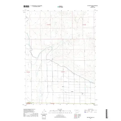
2017 Map of Dry Sheep Creek
USGS Topo · Published 2017About this map
The agricultural landscape of Sioux County, Nebraska, is defined by an intricate network of irrigation infrastructure centered around the Interstate Canal. This 2017 survey reveals the reliance of the High Plains on managed water, with numerous numbered laterals including Lateral 7 Main and Lateral 14 Main branching out to support local farming operations. Small rural communities and historic localities such as Roach, Scoville, and Dutch Flats are positioned along this corridor, serving as local anchors for the surrounding ranchland. The natural drainage of Dry Sheep Cr cuts through the terrain, providing a stark contrast to the straight-line geometry of the man-made canals and the section-line roads like Morrill Rd and Liberty Oil Rd that crisscross the prairie.
Find a feature on this map
35 named features on this map. Tap any name to fly to it.
Don’t see what you’re looking for? This feature index may not catch every label — zoom into the map to look around manually.
Map Details
Editions of this 2017 Dry Sheep Creek Map
This is the sole edition of this map. No revisions or reprints were ever made.
Other maps of this area

1896 · Patrick
USGS Topo · 1:125,000

1898 · Scotts Bluff
USGS Topo · 1:125,000

1899 · Goshen Hole
USGS Topo · 1:125,000

1899 · Whistle Creek
USGS Topo · 1:125,000

1954 · Scottsbluff
USGS Topo · 1:250,000

1954 · Torrington
USGS Topo · 1:250,000

1954 · Cheyenne
USGS Topo · 1:250,000

1955 · Alliance
USGS Topo · 1:250,000

1957 · Alliance
USGS Topo · 1:250,000

1958 · Cheyenne
USGS Topo · 1:250,000