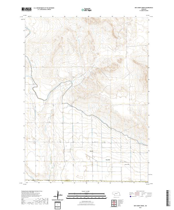
2021 Map of Dry Sheep Creek
USGS Topo · Published 2021About this map
Interstate Canal snakes across the Sioux County landscape, defining the agricultural character of this Nebraska panhandle region. This 2021 survey illustrates a sophisticated network of water management, where numerous branches such as Lateral 11 Main and Lateral Number 10 distribute water from the main canal to the surrounding fields. The topography is dominated by the drainage of Dry Sheep Cr, which flows southward toward the boundary of Scotts Bluff County. Small historical community centers like Roach and Scoville are positioned along the grid of rural roads, including Liberty Oil Rd and S B RD. To the southeast, the open terrain of Dutch Flats represents the high-plains agriculture that has long sustained the area. The map's detail provides a clear view of the complex irrigation infrastructure that allows this arid environment to remain productive, marking the intersection of natural watercourses and human-engineered systems.
Find a feature on this map
37 named features on this map. Tap any name to fly to it.
Don’t see what you’re looking for? This feature index may not catch every label — zoom into the map to look around manually.
Map Details
Editions of this 2021 Dry Sheep Creek Map
This is the sole edition of this map. No revisions or reprints were ever made.
Other maps of this area

1896 · Patrick
USGS Topo · 1:125,000

1898 · Scotts Bluff
USGS Topo · 1:125,000

1899 · Goshen Hole
USGS Topo · 1:125,000

1899 · Whistle Creek
USGS Topo · 1:125,000

1954 · Scottsbluff
USGS Topo · 1:250,000

1954 · Torrington
USGS Topo · 1:250,000

1954 · Cheyenne
USGS Topo · 1:250,000

1955 · Alliance
USGS Topo · 1:250,000

1957 · Alliance
USGS Topo · 1:250,000

1958 · Cheyenne
USGS Topo · 1:250,000