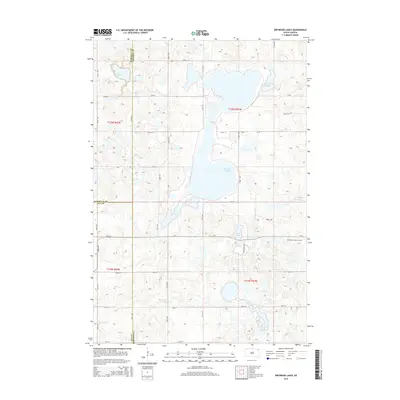
2015 Map of Drywood Lakes
USGS Topo · Published 2015About this map
Drywood Lakes and a complex network of glacial wetlands dominate this South Dakota landscape at the convergence of Marshall, Roberts, and Day counties. The terrain is characterized by a high density of water bodies, including Lake Martha and Lake Whipple in the north, and the smaller Tahana Lake and Oneroad Lake to the south. This geography dictates a rigid, grid-based road system that must navigate around these basins, seen in the paths of 122nd St and CR-5.
Find a feature on this map
26 named features on this map. Tap any name to fly to it.
Don’t see what you’re looking for? This feature index may not catch every label — zoom into the map to look around manually.
Map Details
Editions of this 2015 Drywood Lakes Map
This is the sole edition of this map. No revisions or reprints were ever made.
Other maps of this area

1953 · Milbank
USGS Topo · 1:250,000

1958 · Milbank
USGS Topo · 1:250,000

1970 · Whitestone Lake
USGS Topo · 1:24,000

1970 · Sisseton
USGS Topo · 1:24,000

1970 · Summit NE
USGS Topo · 1:24,000

1970 · South Red Iron Lake
USGS Topo · 1:24,000

1970 · Piyas Lake
USGS Topo · 1:24,000

1970 · Enemy Swim Lake East
USGS Topo · 1:24,000

1970 · Goodwill
USGS Topo · 1:24,000

1970 · Drywood Lakes
USGS Topo · 1:24,000