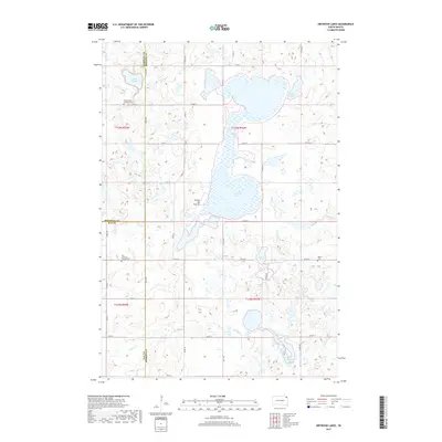
2017 Map of Drywood Lakes
USGS Topo · Published 2017About this map
The glacial highlands of the Coteau des Prairies dominate this northeastern South Dakota landscape, where a dense network of water bodies defines the local geography. At the center of the sheet, the expansive Drywood Lakes are joined by smaller basins including Lake Whipple, Lake Martha, and Tahana Lake. This high-plateau region, situated at the meeting point of Marshall, Day, and Roberts Counties, reflects a quiet rural character structured by a precise grid of gravel roads like 122nd St and 127th St. For the local historian, the map preserves the location of traditional community centers, notably the Buffalo Lake Lutheran Cem, Zoar Lutheran Church Cem, and Bethel Cem. These sites, along with watercourses such as Goodwill Cr and Chekepa Cr, offer a window into the settlement patterns of this prairie upland.
Find a feature on this map
30 named features on this map. Tap any name to fly to it.
Don’t see what you’re looking for? This feature index may not catch every label — zoom into the map to look around manually.
Map Details
Editions of this 2017 Drywood Lakes Map
This is the sole edition of this map. No revisions or reprints were ever made.
Other maps of this area

1953 · Milbank
USGS Topo · 1:250,000

1958 · Milbank
USGS Topo · 1:250,000

1970 · Whitestone Lake
USGS Topo · 1:24,000

1970 · Sisseton
USGS Topo · 1:24,000

1970 · Summit NE
USGS Topo · 1:24,000

1970 · South Red Iron Lake
USGS Topo · 1:24,000

1970 · Piyas Lake
USGS Topo · 1:24,000

1970 · Enemy Swim Lake East
USGS Topo · 1:24,000

1970 · Goodwill
USGS Topo · 1:24,000

1970 · Drywood Lakes
USGS Topo · 1:24,000