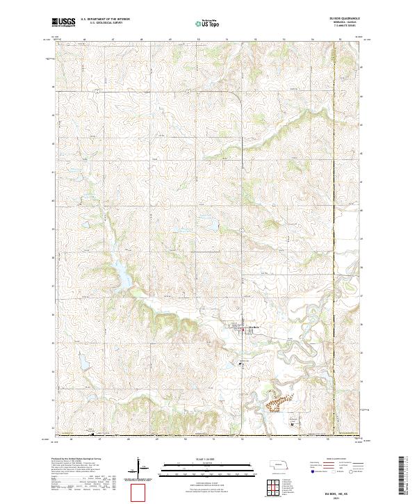
2021 Map of Du Bois
USGS Topo · Published 2021About this map
Du Bois sits at the heart of this landscape, where the South Fork Big Nemaha River curves through the borderlands of Pawnee and Richardson counties. The village grid is clearly defined by local streets like Walnut St and Locust St, serving as a central hub for the surrounding agricultural sections. The area is marked by a series of water management features, including South Fork Reservoir 11-1 and South Fork Reservoir 2-6, which dot the drainages of Lores Branch and Dry Br. Genealogy researchers will find significant value in the distribution of local burial grounds, ranging from the DuBois Cem just south of the village to the more distant Saint Peters Cem near the western edge and Cincinnati Cem positioned along the southern state line.
Find a feature on this map
46 named features on this map. Tap any name to fly to it.
Don’t see what you’re looking for? This feature index may not catch every label — zoom into the map to look around manually.
Map Details
Editions of this 2021 Du Bois Map
This is the sole edition of this map. No revisions or reprints were ever made.
Other maps of this area

1888 · Hiawatha
USGS Topo · 1:125,000

1889 · Seneca
USGS Topo · 1:125,000

1894 · Seneca
USGS Topo · 1:125,000

1894 · Hiawatha
USGS Topo · 1:125,000

1916 · Humboldt
USGS Topo · 1:62,500

1950 · Kansas City
USGS Topo · 1:250,000

1954 · Kansas City
USGS Topo · 1:250,000

1955 · Manhattan
USGS Topo · 1:250,000

1955 · Nebraska City
USGS Topo · 1:250,000

1955 · Lincoln
USGS Topo · 1:250,000