
Loading...
Loading map...2023 Map of Duanesburg
USGS Topo · Published 2023About this map
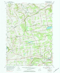
Duanesburg and Delanson serve as the primary hubs in this portion of Schenectady County, situated where the CSX Transportation line and the Western Tpke converge. The landscape is defined by a series of high points like Bean Hill and Shellstone Hill, which overlook a network of creeks including South Chuctanunda Creek and the Normans Kill.
Find a feature on this map
121 named features on this map. Tap any name to fly to it.
Don’t see what you’re looking for? This feature index may not catch every label — zoom into the map to look around manually.
Map Details
Date Portrayed2023
Date Published2023
PublisherU.S. Geological Survey
Map TypeTopographic
Scale1:24000
Physical Dimensions24 x 29 inches
Editions of this 2023 Duanesburg Map
This is the sole edition of this map. No revisions or reprints were ever made.
Historical Maps of Scotch Bush Through Time
6 maps found


Featured Locations
Source Details
SourceU.S. Geological Survey
CopyrightPublic Domain