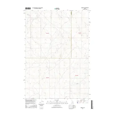
2017 Map of Dubois SE
USGS Topo · Published 2017About this map
Camas Cr flows through this high-altitude landscape along the border of Clark Co and Fremont Co. The terrain is defined by its drainage patterns and a sparse network of backroads, including Laird Rock Rd in the northwest and Davis Lake Rd in the southeast. This 2017 survey reveals an area largely dedicated to open space and resource management, with precise township and range designations such as t9n r37e and t8n r38e marking the legal grid of the American West. The lack of concentrated settlements highlights the region's character as a working landscape of the Eastern Idaho plains.
Find a feature on this map
8 named features on this map. Tap any name to fly to it.
Don’t see what you’re looking for? This feature index may not catch every label — zoom into the map to look around manually.
Map Details
Editions of this 2017 Dubois SE Map
This is the sole edition of this map. No revisions or reprints were ever made.
Other maps of this area

1951 · Plano
USGS Topo · 1:24,000

1955 · Dubois
USGS Topo · 1:250,000

1955 · Idaho Falls
USGS Topo · 1:250,000

1955 · Ashton
USGS Topo · 1:250,000

1955 · Driggs
USGS Topo · 1:250,000

1958 · Driggs
USGS Topo · 1:250,000

1958 · Dubois
USGS Topo · 1:250,000

1958 · Idaho Falls
USGS Topo · 1:250,000

1958 · Ashton
USGS Topo · 1:250,000

1960 · Ashton
USGS Topo · 1:250,000