
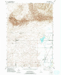
1951 Map of Plano
USGS Topo · Published 1953About this map
Sand Dunes dominate the northern landscape of this region, meeting the agricultural irrigation networks of the Snake River Valley at the Fremont and Madison county lines. The transition from the high, sandy elevations of Sand Mountain and Ninemile Knoll to the lower farming plains is facilitated by an intricate system of waterways, including the St Anthony Union Canal and the North Branch Independent Canal. At the center of this rural landscape are the small communities of Plano and Edmonds, which serve as the primary hubs for the local population. Near the settlement of Plano, researchers will find the Plano Cem and a prominent Water Tank, illustrating the vital infrastructure required for life on the edge of the desert. The presence of Quayles Lake provides a rare natural water feature amidst the man-made canals that define the area's twentieth-century development.
Find a feature on this map
15 named features on this map. Tap any name to fly to it.
Don’t see what you’re looking for? This feature index may not catch every label — zoom into the map to look around manually.
Map Details
Editions of this 1951 Plano Map
2 editions found
Other maps of this area

1948 · Parker
USGS Topo · 1:24,000

1949 · Rexburg
USGS Topo · 1:24,000

1950 · Parker
USGS Topo · 1:24,000

1950 · Rexburg
USGS Topo · 1:24,000
1951 · Menan Buttes
USGS Topo · 1:24,000

1955 · Dubois
USGS Topo · 1:250,000

1955 · Idaho Falls
USGS Topo · 1:250,000

1955 · Ashton
USGS Topo · 1:250,000

1955 · Driggs
USGS Topo · 1:250,000

1958 · Driggs
USGS Topo · 1:250,000