
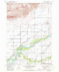
1948 Map of Parker
USGS Topo · Published 1973About this map
Henrys Fork and the Teton River dominate the southern half of this mid-century Idaho landscape, defining a complex network of wetlands and agricultural canals. The region, positioned at the edge of the extensive Sand Dunes and the Begin Bench, reveals a transition from the stark northern dunes to the irrigated plains of the Snake River Valley. Small agricultural communities such as Parker, Heman, and Egin are linked by the Union Pacific railroad and a grid of essential water systems, including the Last Chance Canal and St Anthony Canal. The presence of the Fort Henry Historic Monument near the river fork notes the area's early frontier history, while the local Cem near Parker and the site of a dismantled RR provide valuable touchpoints for genealogists and industrial historians.
Find a feature on this map
31 named features on this map. Tap any name to fly to it.
Don’t see what you’re looking for? This feature index may not catch every label — zoom into the map to look around manually.
Map Details
Editions of this 1948 Parker Map
2 editions found
Other maps of this area

1949 · Rexburg
USGS Topo · 1:24,000

1950 · Parker
USGS Topo · 1:24,000

1950 · Rexburg
USGS Topo · 1:24,000

1950 · St Anthony
USGS Topo · 1:24,000

1951 · Moody
USGS Topo · 1:24,000
1951 · Menan Buttes
USGS Topo · 1:24,000

1951 · Plano
USGS Topo · 1:24,000

1955 · Ashton
USGS Topo · 1:250,000

1955 · Driggs
USGS Topo · 1:250,000

1958 · Driggs
USGS Topo · 1:250,000