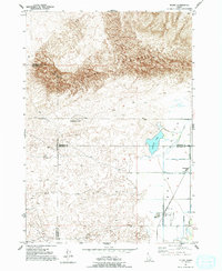
1951 Map of Plano
USGS Topo · Published 1994About this map
Plano sits at the intersection of three counties—Fremont, Jefferson, and Madison—on this 1951 topographic survey. The landscape is defined by the dramatic geological transition between the cultivated lands of the Snake River Plain and the encroaching St Anthony Sand Dunes. To the north, the massive Sand Mountain and the distinct Ninemile Knoll rise from the desert floor, showing the wind-swept terrain before it reaches the agricultural fringes.
Find a feature on this map
14 named features on this map. Tap any name to fly to it.
Don’t see what you’re looking for? This feature index may not catch every label — zoom into the map to look around manually.
Map Details
Editions of this 1951 Plano Map
2 editions found
Other maps of this area

1948 · Parker
USGS Topo · 1:24,000

1949 · Rexburg
USGS Topo · 1:24,000

1950 · Parker
USGS Topo · 1:24,000

1950 · Rexburg
USGS Topo · 1:24,000
1951 · Menan Buttes
USGS Topo · 1:24,000

1951 · Plano
USGS Topo · 1:24,000

1955 · Dubois
USGS Topo · 1:250,000

1955 · Idaho Falls
USGS Topo · 1:250,000

1955 · Ashton
USGS Topo · 1:250,000

1955 · Driggs
USGS Topo · 1:250,000