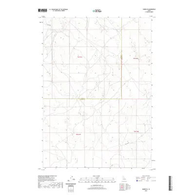
2020 Map of Dubois SE
USGS Topo · Published 2020About this map
Camas Cr cuts through this high desert landscape, highlighting the natural drainage patterns of this corner of Fremont County. The map documents a predominantly open terrain where the boundary between Clark and Fremont Counties runs north to south through the center of the sheet. Transportation is limited to a few specific corridors, primarily Laird Rock Rd in the north and Davis Lake Rd in the southeast. These routes, alongside the local 800 N road, provide the only established access through the Public Land Survey System grids of t9n r37e and t8n r38e. The lack of dense development indicates a region characterized by its topography rather than urban centers, typical of the rural land use and livestock range found in this part of eastern Idaho.
Find a feature on this map
9 named features on this map. Tap any name to fly to it.
Don’t see what you’re looking for? This feature index may not catch every label — zoom into the map to look around manually.
Map Details
Editions of this 2020 Dubois SE Map
This is the sole edition of this map. No revisions or reprints were ever made.
Other maps of this area

1951 · Plano
USGS Topo · 1:24,000

1955 · Dubois
USGS Topo · 1:250,000

1955 · Idaho Falls
USGS Topo · 1:250,000

1955 · Ashton
USGS Topo · 1:250,000

1955 · Driggs
USGS Topo · 1:250,000

1958 · Driggs
USGS Topo · 1:250,000

1958 · Dubois
USGS Topo · 1:250,000

1958 · Idaho Falls
USGS Topo · 1:250,000

1958 · Ashton
USGS Topo · 1:250,000

1960 · Ashton
USGS Topo · 1:250,000