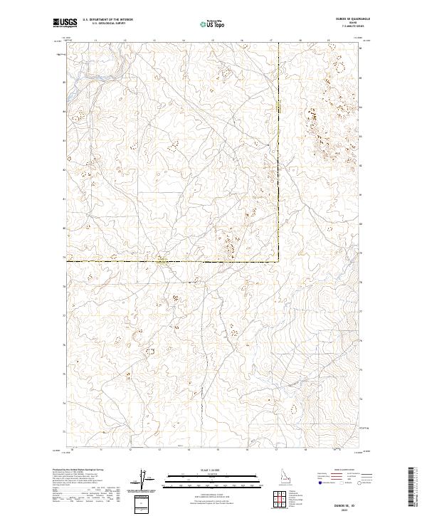
2023 Map of Dubois SE
USGS Topo · Published 2023About this map
The border of Clark Co Fremont Co bisects this high desert landscape, which remains largely defined by the Public Land Survey System grids of t9n r37e, t9n r38e, t8n r37e, and t8n r38e. In the northern reach of this quadrangle, Camas Creek winds through the terrain, a primary water source in a region otherwise marked by sparse infrastructure. The presence of Davis Lake Rd in the southeastern corner provides one of the few named navigational routes through these expansive rangelands. This map illustrates the intersection of administrative boundaries and natural watercourses, reflecting the logistical challenges and survey patterns of rural eastern Idaho.
Find a feature on this map
7 named features on this map. Tap any name to fly to it.
Don’t see what you’re looking for? This feature index may not catch every label — zoom into the map to look around manually.
Map Details
Editions of this 2023 Dubois SE Map
This is the sole edition of this map. No revisions or reprints were ever made.
Other maps of this area

1951 · Plano
USGS Topo · 1:24,000

1955 · Dubois
USGS Topo · 1:250,000

1955 · Idaho Falls
USGS Topo · 1:250,000

1955 · Ashton
USGS Topo · 1:250,000

1955 · Driggs
USGS Topo · 1:250,000

1958 · Driggs
USGS Topo · 1:250,000

1958 · Dubois
USGS Topo · 1:250,000

1958 · Idaho Falls
USGS Topo · 1:250,000

1958 · Ashton
USGS Topo · 1:250,000

1960 · Ashton
USGS Topo · 1:250,000