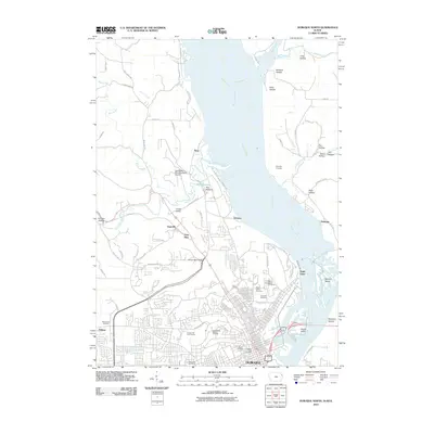
2010 Map of Dubuque North
USGS Topo · Published 2010About this map
The Mississippi River defines the eastern edge of this landscape, carving a wide path past Eagle Point and into the industrial and residential heart of northern Dubuque. To the west, the city's growth extends toward Asbury, while the northern reaches maintain a more rural character around settlements like Sageville and the landing area of Peru Bottoms. A notable concentration of memorial sites, including Linwood Cemetery, Mount Calvary Cemetery, and Saint Johns Cemetery, occupies the bluffs overlooking the river valley, providing significant points of interest for genealogists tracing local history.
Find a feature on this map
81 named features on this map. Tap any name to fly to it.
Don’t see what you’re looking for? This feature index may not catch every label — zoom into the map to look around manually.
Map Details
Editions of this 2010 Dubuque North Map
This is the sole edition of this map. No revisions or reprints were ever made.
Other maps of this area

1900 · Lancaster
USGS Topo · 1:125,000

1901 · Peosta
USGS Topo · 1:125,000

1904 · Lancaster
USGS Topo · 1:125,000

1908 · Lancaster
USGS Topo · 1:125,000

1935 · East Dubuque
USGS Topo · 1:62,500

1940 · East Dubuque
USGS Topo · 1:62,500

1955 · Menominee
USGS Topo · 1:24,000

1955 · Dubuque South
USGS Topo · 1:24,000

1955 · Balltown
USGS Topo · 1:24,000

1956 · Dubuque North
USGS Topo · 1:24,000