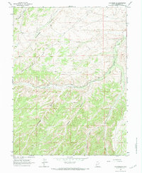
1964 Map of Duchesne SE
USGS Topo · Published 1984About this map
Cottonwood Ridge forms a prominent geographical spine across this 1964 survey of the Utah high country southeast of Duchesne. The landscape is defined by an intricate network of deep drainages, most notably Sowers Canyon and Antelope Canyon, which collect the seasonal flows of Sowers Creek and Antelope Creek. Early industrial activity is evidenced by an Oil Well located near the basin floor of Sowers Canyon, indicating the mid-century expansion of energy exploration into these remote territories. This topographical study, based on 1962 aerial photography, captures the primitive infrastructure of the era, consisting primarily of a Jeep Trail winding through Coyote Canyon. The convergence of the Right Fork and Left Fork at the southern end of the sheet reveals the natural catchment patterns that shaped local grazing and land use between Cottonwood Canyon and Brundage Canyon.
Find a feature on this map
19 named features on this map. Tap any name to fly to it.
Don’t see what you’re looking for? This feature index may not catch every label — zoom into the map to look around manually.
Map Details
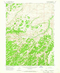
Editions of this 1964 Duchesne SE Map
2 editions found
Other maps of this area

1885 · Uinta
USGS Topo · 1:250,000

1886 · Price River
USGS Topo · 1:250,000

1896 · Price River
USGS Topo · 1:250,000

1939 · Duchesne
USGS Topo · 1:125,000

1954 · Salt Lake City
USGS Topo · 1:250,000

1956 · Price
USGS Topo · 1:250,000

1958 · Salt Lake City
USGS Topo · 1:250,000

1960 · Salt Lake City
USGS Topo · 1:250,000

1960 · Price
USGS Topo · 1:250,000

1962 · Price
USGS Topo · 1:250,000