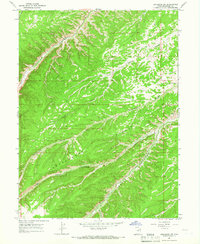
1964 Map of Duchesne SW
USGS Topo · Published 1966About this map
Indian Canyon and the high elevations of Cottonwood Ridge dominate this mid-1960s survey of the Duchesne region. The terrain is characterized by a series of deep drainage systems, including Sowers Canyon and Tabby Canyon, which reveal the complex geography of the Uintah Basin's southern reaches. Unlike more settled valleys, this landscape is defined by remote infrastructure, featuring scattered mines and a well situated near Wire Fence Canyon. A network of simple trails and jeep trails provides the only access through the winding corridors of Cottonwood Canyon and Coyote Canyon. Water sources like Marshall Springs appear as critical landmarks for anyone navigating this high-country environment before modern development. The map's contour lines and labels illustrate a period of extractive interest and land management by the Geological Survey during a time when much of the area remained largely inaccessible by standard road.
Find a feature on this map
16 named features on this map. Tap any name to fly to it.
Don’t see what you’re looking for? This feature index may not catch every label — zoom into the map to look around manually.
Map Details
Editions of this 1964 Duchesne SW Map
2 editions found
Other maps of this area

1885 · Uinta
USGS Topo · 1:250,000

1886 · Price River
USGS Topo · 1:250,000

1896 · Price River
USGS Topo · 1:250,000

1939 · Duchesne
USGS Topo · 1:125,000

1954 · Salt Lake City
USGS Topo · 1:250,000

1956 · Price
USGS Topo · 1:250,000

1958 · Salt Lake City
USGS Topo · 1:250,000

1960 · Salt Lake City
USGS Topo · 1:250,000

1960 · Price
USGS Topo · 1:250,000

1962 · Price
USGS Topo · 1:250,000