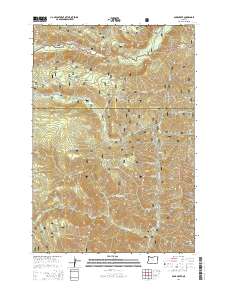
2014 Map of Duck Creek
USGS Topo · Published 2014About this map
The Wallowa National Forest and Whitman National Forest converge at the boundary of Wallowa and Baker counties, creating a landscape defined by an intricate network of drainages. The Imnaha River flows through the northern reaches of the quadrangle, flanked by access routes like Upper Imnaha Rd and Coverdale Rd 16. This 2014 survey documents a territory shaped by water and timber management, where numerous creeks such as Duck Creek, Lake Fork Cr, and Dutchman Cr carve deep paths through the timberlands. Notable landmarks like Cold Springs and Rock Spring indicate important water sources for both wildlife and early travelers. The presence of the Wallowa Mountain Loop and various National Forest Development Roads illustrates the established infrastructure for forest administration and recreation in this portion of the Pacific Northwest.
Find a feature on this map
35 named features on this map. Tap any name to fly to it.
Don’t see what you’re looking for? This feature index may not catch every label — zoom into the map to look around manually.
Map Details
Editions of this 2014 Duck Creek Map
This is the sole edition of this map. No revisions or reprints were ever made.
Other maps of this area

1915 · Pine
USGS Topo · 1:125,000

1954 · Cornucopia
USGS Topo · 1:62,500

1955 · Baker
USGS Topo · 1:250,000

1955 · Grangeville
USGS Topo · 1:250,000

1957 · Halfway
USGS Topo · 1:62,500

1957 · Homestead
USGS Topo · 1:62,500

1957 · Copperfield
USGS Topo · 1:62,500

1959 · Baker
USGS Topo · 1:250,000

1959 · Grangeville
USGS Topo · 1:250,000

1980 · McCall
USGS Topo · 1:100,000