
1957 Map of Halfway
USGS Topo · Published 1958About this map
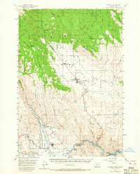
Eagle Valley forms the agricultural heart of this survey, where the settlements of Halfway, Richland, and New Bridge are situated amidst a network of irrigation ditches and creeks. This 1957 field check captures the region during a significant period of topographical change; blue hatching along the Powder River near Robinette indicates the massive area slated to be submerged by the impending construction of the Brownlee Dam. Higher elevations to the north are dominated by the Whitman National Forest, featuring landmarks like the McBride Guard Sta and the Mehlhorn Mill. The map documents the vital community infrastructure of the era, from the Union HS and Rodeo Grounds in Halfway to the remote Summit Point Lookout Point and various Jeep Trails that provided access to the timbered backcountry.
Find a feature on this map
70 named features on this map. Tap any name to fly to it.
Don’t see what you’re looking for? This feature index may not catch every label — zoom into the map to look around manually.
Map Details
Editions of this 1957 Halfway Map
2 editions found
Other maps of this area

1915 · Pine
USGS Topo · 1:125,000

1954 · Cornucopia
USGS Topo · 1:62,500

1954 · Eagle Cap
USGS Topo · 1:62,500

1955 · Baker
USGS Topo · 1:250,000

1955 · Grangeville
USGS Topo · 1:250,000

1957 · Homestead
USGS Topo · 1:62,500

1957 · Copperfield
USGS Topo · 1:62,500

1957 · Sparta
USGS Topo · 1:62,500

1957 · Sturgill Peak
USGS Topo · 1:62,500

1957 · Durkee
USGS Topo · 1:62,500