
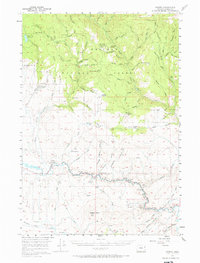
1957 Map of Sparta
USGS Topo · Published 1958About this map
Gold and copper mining operations define this mid-century look at the high country within Whitman National Forest. The landscape is densely marked by the region’s industrial history, featuring numerous named sites such as the Sanger Mine, Poorman Mine, and Rosebud Mine. These operations are concentrated around prominent peaks like Sparta Butte and Red Knob, where complex topography gives way to deep drainages like Crystal Palace Gulch. In the lower elevations, the Powder River serves as a primary geographic anchor, followed by the Baker-Homestead Highway. The presence of Colvard Station and the Lily White Guard Sta illustrates the infrastructure required to manage these remote timber and mineral resources. Small cemeteries and local landmarks like Pritchard Flat offer specific points of interest for those tracing the settlement patterns of eastern Oregon’s rugged interior.
Find a feature on this map
36 named features on this map. Tap any name to fly to it.
Don’t see what you’re looking for? This feature index may not catch every label — zoom into the map to look around manually.
Map Details
Editions of this 1957 Sparta Map
2 editions found
Other maps of this area

1901 · Baker City
USGS Topo · 1:125,000

1906 · Telocaset
USGS Topo · 1:125,000

1915 · Pine
USGS Topo · 1:125,000

1954 · Cornucopia
USGS Topo · 1:62,500

1954 · Eagle Cap
USGS Topo · 1:62,500

1955 · Baker
USGS Topo · 1:250,000

1955 · Grangeville
USGS Topo · 1:250,000

1957 · Halfway
USGS Topo · 1:62,500

1957 · Durkee
USGS Topo · 1:62,500

1957 · Mineral
USGS Topo · 1:62,500