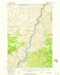
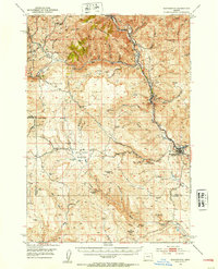
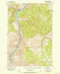
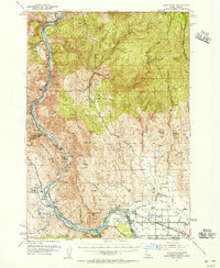
1957 Map of Mineral
USGS Topo · Published 1959About this map
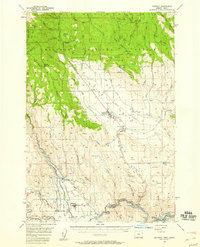
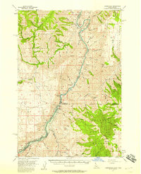
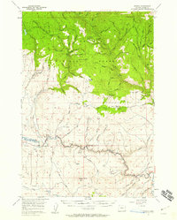
The Union Pacific railroad corridor follows the winding course of the Snake River along the border of Baker and Washington counties, marking a landscape defined by high-elevation mining and timber. In this late 1950s survey, the small settlements of Mineral and Home appear as central points for local activity, surrounded by several family and industrial operations including the Mineral Mine, Mortimer Mine, and Connor Creek Mine. A private Cable Ferry (Pvt) provides a crossing point near the railroad, serving as a critical link before the anticipated changes of the Brownlee Dam project.
Find a feature on this map
84 named features on this map. Tap any name to fly to it.
Don’t see what you’re looking for? This feature index may not catch every label — zoom into the map to look around manually.
Map Details
Editions of this 1957 Mineral Map
This is the sole edition of this map. No revisions or reprints were ever made.
Other maps of this area

1897 · Weiser
USGS Topo · 1:125,000

1915 · Pine
USGS Topo · 1:125,000
1951 · Huntington
USGS Topo · 1:62,500
1952 · Olds Ferry NW
USGS Topo · 1:24,000
1952 · Olds Ferry
USGS Topo · 1:62,500

1953 · Mann Creek
USGS Topo · 1:62,500

1955 · Baker
USGS Topo · 1:250,000
1957 · Halfway
USGS Topo · 1:62,500
1957 · Copperfield
USGS Topo · 1:62,500
1957 · Sparta
USGS Topo · 1:62,500