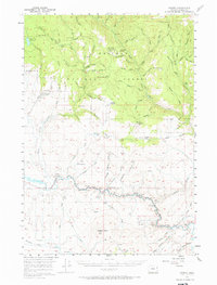
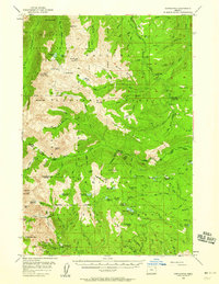
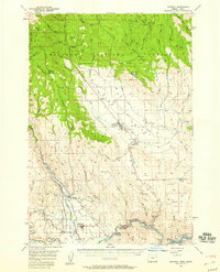
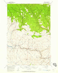
1957 Map of Sparta
USGS Topo · Published 1966About this map
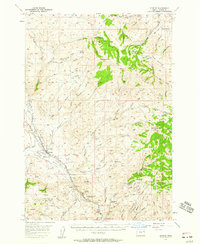
Mining operations and remote homesteads define the high country of the Whitman National Forest in this mid-century survey. The settlement of Sparta sits near the center of a landscape carved by deep gulches and numerous lode mines, including the Sanger Mine, Poorman Mine, and Amalgamated Mine. These workings are concentrated along the drainages of Eagle Creek and Goose Creek, illustrating the intense geological exploration that shaped Baker County's history.
Find a feature on this map
117 named features on this map. Tap any name to fly to it.
Don’t see what you’re looking for? This feature index may not catch every label — zoom into the map to look around manually.
Map Details
Editions of this 1957 Sparta Map
2 editions found
Other maps of this area

1901 · Baker City
USGS Topo · 1:125,000

1906 · Telocaset
USGS Topo · 1:125,000

1915 · Pine
USGS Topo · 1:125,000
1954 · Cornucopia
USGS Topo · 1:62,500

1954 · Eagle Cap
USGS Topo · 1:62,500

1955 · Baker
USGS Topo · 1:250,000

1955 · Grangeville
USGS Topo · 1:250,000
1957 · Halfway
USGS Topo · 1:62,500
1957 · Sparta
USGS Topo · 1:62,500
1957 · Durkee
USGS Topo · 1:62,500