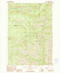
1990 Map of Duck Creek
USGS Topo · Published 1990About this map
Hells Canyon defines this landscape along the border of Wallowa and Baker counties, where the Imnaha River flows through the northern reaches of the Wallowa National Forest. This 1990 edition, based on earlier field checks and aerial photography, documents a network of primitive roads and trails that connect remote recreational outposts within the Whitman National Forest. The map traces a high-elevation drainage system including Duck Creek, Lake Fork Creek, and North Pine Creek, which carve deep through the canyon geography. Outdoor heritage is well-represented by several isolated sites such as Evergreen Campground, Hidden Campground, and Lake Fork Campground. Further south, the Hells Canyon National Recreation Area designation indicates the transition toward managed wilderness. Researchers will find interest in the specific placement of high-country resources like Rock Spring and the Duck Lake Cpgrd near the edge of the canyon rim.
Find a feature on this map
35 named features on this map. Tap any name to fly to it.
Don’t see what you’re looking for? This feature index may not catch every label — zoom into the map to look around manually.
Map Details
Editions of this 1990 Duck Creek Map
This is the sole edition of this map. No revisions or reprints were ever made.
Other maps of this area

1915 · Pine
USGS Topo · 1:125,000

1954 · Cornucopia
USGS Topo · 1:62,500

1955 · Baker
USGS Topo · 1:250,000

1955 · Grangeville
USGS Topo · 1:250,000

1957 · Halfway
USGS Topo · 1:62,500

1957 · Homestead
USGS Topo · 1:62,500

1957 · Copperfield
USGS Topo · 1:62,500

1959 · Baker
USGS Topo · 1:250,000

1959 · Grangeville
USGS Topo · 1:250,000

1980 · McCall
USGS Topo · 1:100,000