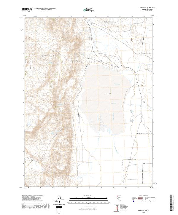
2021 Map of Duck Lake
USGS Topo · Published 2021About this map
The Warner Mountains dominate the western edge of this High Desert landscape, descending into the Tuledad Valley and the expansive Duck Flat. This 2021 survey of northern Washoe County highlights the distinct hydrology of the Great Basin, where seasonal drainages like Wall Creek and Tuledad Creek flow toward the ephemeral Duck Lake. The terrain is marked by essential water sources for cattle and wildlife, including Cocklebur Spring, Willow Spring, and the curiously named Apple Orchard Spring situated at the base of the Coppersmith Hills. Further east, the topography transitions to the low-lying sinks of Little Potholes and Big Pothole. The infrastructure is sparse, defined primarily by S R 447 and the Duck Lake Loop, reflecting a landscape dedicated to open range and remote volcanic uplands.
Find a feature on this map
26 named features on this map. Tap any name to fly to it.
Don’t see what you’re looking for? This feature index may not catch every label — zoom into the map to look around manually.
Map Details
Editions of this 2021 Duck Lake Map
This is the sole edition of this map. No revisions or reprints were ever made.
Other maps of this area

1886 · Alturas
USGS Topo · 1:250,000

1886 · Honey Lake
USGS Topo · 1:250,000

1886 · Granite Range
USGS Topo · 1:250,000

1889 · Long Valley
USGS Topo · 1:250,000

1891 · Honey Lake
USGS Topo · 1:250,000

1892 · Alturas
USGS Topo · 1:250,000

1893 · Honey Lake
USGS Topo · 1:250,000

1894 · Granite Range
USGS Topo · 1:250,000

1954 · Observation Peak
USGS Topo · 1:62,500

1954 · Vya
USGS Topo · 1:250,000