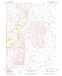
1979 Map of Duck Lake
USGS Topo · Published 1980About this map
Coppersmith Hills rise sharply along the western edge of this High Desert landscape, overlooking the broad expanse of Duck Lake and the Duck Flat (Depression). This 1979 survey captures a remote ranching and aviation environment where water is the primary geographic driver, evidenced by numerous named water sources like Cocklebur Spring, Mason Spring, and Apple Orchard Spring.
Find a feature on this map
24 named features on this map. Tap any name to fly to it.
Don’t see what you’re looking for? This feature index may not catch every label — zoom into the map to look around manually.
Map Details
Editions of this 1979 Duck Lake Map
2 editions found
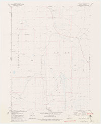
Other maps of this area

1886 · Alturas
USGS Topo · 1:250,000

1886 · Honey Lake
USGS Topo · 1:250,000

1886 · Granite Range
USGS Topo · 1:250,000

1889 · Long Valley
USGS Topo · 1:250,000

1891 · Honey Lake
USGS Topo · 1:250,000

1892 · Alturas
USGS Topo · 1:250,000

1893 · Honey Lake
USGS Topo · 1:250,000

1894 · Granite Range
USGS Topo · 1:250,000

1954 · Observation Peak
USGS Topo · 1:62,500

1954 · Vya
USGS Topo · 1:250,000