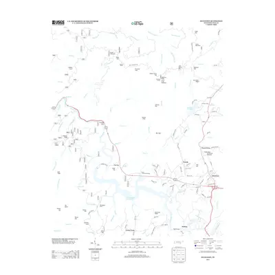
2013 Map of Ducktown
USGS Topo · Published 2013About this map
Ducktown and the surrounding mining district of the Copper Basin define this southeastern Tennessee landscape. The Ocoee River serves as the central drainage, its course marked by industrial infrastructure such as the Ocoee Flume and Ocoee Number Three Lake. The terrain is deeply partitioned by ridges and peaks, notably Little Frog Mountain and the prominent Copper Basin Ketchersid Mountain overlooking the settlement at Chanceytown. Local history is preserved in named sites like Hedden Grave and Jenkins Grave, while the region's rail heritage is visible at Stansbury Siding along the northern banks of Campbell Cove Lake. Smaller communities such as Postelle, Dogtown, and McHarg are connected by a network of local roads including Chanceytown Rd and Postelle Rd, reflecting a landscape shaped by both its mountain geography and long-standing industrial presence.
Find a feature on this map
130 named features on this map. Tap any name to fly to it.
Don’t see what you’re looking for? This feature index may not catch every label — zoom into the map to look around manually.
Map Details
Editions of this 2013 Ducktown Map
This is the sole edition of this map. No revisions or reprints were ever made.
Other maps of this area

1886 · Dalton
USGS Topo · 1:125,000

1886 · Cleveland
USGS Topo · 1:125,000

1888 · Ellijay
USGS Topo · 1:125,000

1892 · Cleveland
USGS Topo · 1:125,000

1892 · Ellijay
USGS Topo · 1:125,000

1892 · Dalton
USGS Topo · 1:125,000

1893 · Murphy
USGS Topo · 1:125,000

1895 · Cleveland
USGS Topo · 1:125,000

1897 · Dalton
USGS Topo · 1:125,000

1898 · Ellijay
USGS Topo · 1:125,000