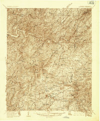
1936 Map of Ducktown
USGS Topo · Published 1936About this map
The Copper Basin industrial landscape dominates this mid-1930s survey, centered on the heavy extraction activities of the Tennessee Copper Co RR. Significant mining operations including the Burra Burra Mine, Isabella Mine, and Old Tennessee Mine are visible alongside the London Flotation Plant, illustrating the intensive mineral production that defined the region's economy and topography. The Louisville and Nashville RR follows the bends of the Hiwassee River in the north, connecting settlements like Farner and Apalachia to the broader world.
Find a feature on this map
114 named features on this map. Tap any name to fly to it.
Don’t see what you’re looking for? This feature index may not catch every label — zoom into the map to look around manually.
Map Details
Editions of this 1936 Ducktown Map
This is the sole edition of this map. No revisions or reprints were ever made.
Other maps of this area

1886 · Dalton
USGS Topo · 1:125,000

1886 · Cleveland
USGS Topo · 1:125,000

1888 · Ellijay
USGS Topo · 1:125,000

1892 · Cleveland
USGS Topo · 1:125,000

1892 · Ellijay
USGS Topo · 1:125,000

1892 · Dalton
USGS Topo · 1:125,000

1893 · Murphy
USGS Topo · 1:125,000

1895 · Cleveland
USGS Topo · 1:125,000

1897 · Dalton
USGS Topo · 1:125,000
1898 · Ellijay
USGS Topo · 1:125,000