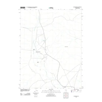
2012 Map of Duckwater
USGS Topo · Published 2012About this map
Duckwater sits at the heart of this high-desert landscape, serving as a focal point for ranching and community life in the expansive Duckwater Valley. The map reveals a reliance on vital water sources such as Big Warm Spring, Little Warm Spring, and Old Collins Spring, which feed into the meandering path of Duckwater Creek. This network of springs and meadows, including Collins Meadow, underpins the local agricultural economy and settlement pattern.
Find a feature on this map
16 named features on this map. Tap any name to fly to it.
Don’t see what you’re looking for? This feature index may not catch every label — zoom into the map to look around manually.
Map Details
Editions of this 2012 Duckwater Map
This is the sole edition of this map. No revisions or reprints were ever made.
Other maps of this area

1951 · Green Springs
USGS Topo · 1:62,500

1956 · Lund
USGS Topo · 1:250,000

1956 · Ely
USGS Topo · 1:250,000

1959 · Ely
USGS Topo · 1:250,000

1960 · Lund
USGS Topo · 1:250,000

1963 · Ely
USGS Topo · 1:250,000

1964 · Duckwater
USGS Topo · 1:62,500

1964 · Moody Peak
USGS Topo · 1:62,500

1968 · Brown Summit
USGS Topo · 1:24,000
1968 · Sand Spring
USGS Topo · 1:24,000