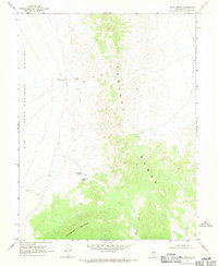
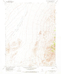
1968 Map of Sand Spring
USGS Topo · Published 1971About this map
Pancake Range dominates the central portion of this 1968 Nevada survey, a high-desert landscape defined by its vital and scarce water sources. The map captures a rugged topography where life and travel are dictated by the presence of intermittent springs, including Sand Spring in the northwest and Martilletti Spring further south. These isolated watering points, along with Portuguese Spring, provided essential stops along the primitive network of Jeep Trails that crisscross the arid basins between the mountains.
Find a feature on this map
10 named features on this map. Tap any name to fly to it.
Don’t see what you’re looking for? This feature index may not catch every label — zoom into the map to look around manually.
Map Details
Editions of this 1968 Sand Spring Map
2 editions found
Other maps of this area

1956 · Lund
USGS Topo · 1:250,000

1960 · Lund
USGS Topo · 1:250,000

1964 · Blue Eagle Springs
USGS Topo · 1:62,500

1964 · Duckwater
USGS Topo · 1:62,500

1968 · Portuguese Mtn
USGS Topo · 1:62,500

1968 · Brown Summit
USGS Topo · 1:24,000
1968 · Brown Summit NW
USGS Topo · 1:24,000
1968 · Brown Summit SW
USGS Topo · 1:24,000

1968 · Portuguese Mtn
USGS Topo · 1:24,000
1968 · Portuguese Mtn NW
USGS Topo · 1:24,000