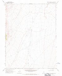
1968 Map of Brown Summit SW
USGS Topo · Published 1971About this map
Big Sand Springs Valley dominates this 1968 Nevada landscape, defining the wide alluvial floor that stretches across Nye County. The terrain is characterized by the broad, intermittent drainage of Sand Springs Wash, which meanders through the valley floor. Mapped during the late 1960s using photogrammetric methods from 1967 aerial photography, the sheet reveals a high desert environment shaped by seasonal water flow and vast open spaces. The network of unimproved roads and survey markers across the valley floor suggests a period of active land surveying and potential resource exploration in this section of the Great Basin.
Find a feature on this map
2 named features on this map. Tap any name to fly to it.
Don’t see what you’re looking for? This feature index may not catch every label — zoom into the map to look around manually.
Map Details
Editions of this 1968 Brown Summit SW Map
2 editions found
Other maps of this area

1956 · Lund
USGS Topo · 1:250,000

1956 · Tonopah
USGS Topo · 1:250,000

1959 · Tonopah
USGS Topo · 1:250,000

1960 · Lund
USGS Topo · 1:250,000

1962 · Tonopah
USGS Topo · 1:250,000

1967 · Moores Station
USGS Topo · 1:62,500

1967 · Chaos Creek
USGS Topo · 1:24,000

1968 · Portuguese Mtn
USGS Topo · 1:62,500

1968 · Brown Summit
USGS Topo · 1:24,000
1968 · Brown Summit NW
USGS Topo · 1:24,000