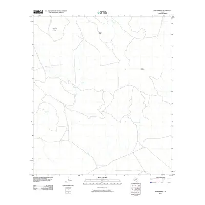
2010 Map of Duff Springs
USGS Topo · Published 2010About this map
Mitchell Mesa dominates the northern landscape of this Brewster County region, where the high desert terrain is defined by its scarce but vital water sources. The namesake Duff Springs and the nearby Davenport Spring represent essential landmarks in an area where local hydrology dictates the pattern of human activity and ranching infrastructure. Arroyos and intermittent drainages like Duff Creek, Goat Creek, and the long Walnut Draw channel seasonal runoff from the higher elevations, carving out features such as Dark Canyon. The presence of the Brush Windmill near the southern boundary highlights the ongoing reliance on groundwater to sustain livestock in this West Texas environment. This 2010 survey illustrates the sparse road network and scattered improvements typical of the Big Bend country's vast ranchlands.
Find a feature on this map
9 named features on this map. Tap any name to fly to it.
Don’t see what you’re looking for? This feature index may not catch every label — zoom into the map to look around manually.
Map Details
Editions of this 2010 Duff Springs Map
This is the sole edition of this map. No revisions or reprints were ever made.
Other maps of this area

1895 · Alpine
USGS Topo · 1:125,000

1917 · Buck Hill
USGS Topo · 1:62,500

1918 · Buck Hill
USGS Topo · 1:62,500

1918 · Jordan Gap
USGS Topo · 1:62,500

1925 · Buck Hill
USGS Topo · 1:62,500

1930 · Jordan Gap
USGS Topo · 1:62,500

1954 · Fort Stockton
USGS Topo · 1:250,000

1958 · Fort Stockton
USGS Topo · 1:250,000

1959 · Emory Peak
USGS Topo · 1:250,000

1965 · Emory Peak
USGS Topo · 1:250,000