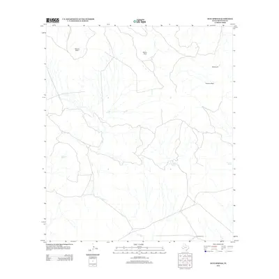
2012 Map of Duff Springs
USGS Topo · Published 2012About this map
Duff Springs and a network of desert water sources define this arid landscape in Brewster County. The drainage patterns of Duff Cr and Goat Cr are central to the terrain, feeding into lower elevations while high prominent landforms like Mitchell Mesa and Kokernot Mesa overlook the territory. The presence of numerous named water points, including Davenport Spring, Cottonwood Spring, and Whirlwind Springs, indicates the critical importance of reliable water for ranching and survival in this Trans-Pecos region. Localized improvements such as Brush Windmill and a feature simply labeled The Ditch reveal the human efforts to manage and direct the flow of water across the varied topography of Walnut Draw and the vicinity of Potatoe Hill.
Find a feature on this map
12 named features on this map. Tap any name to fly to it.
Don’t see what you’re looking for? This feature index may not catch every label — zoom into the map to look around manually.
Map Details
Editions of this 2012 Duff Springs Map
This is the sole edition of this map. No revisions or reprints were ever made.
Other maps of this area

1895 · Alpine
USGS Topo · 1:125,000

1917 · Buck Hill
USGS Topo · 1:62,500

1918 · Buck Hill
USGS Topo · 1:62,500

1918 · Jordan Gap
USGS Topo · 1:62,500

1925 · Buck Hill
USGS Topo · 1:62,500

1930 · Jordan Gap
USGS Topo · 1:62,500

1954 · Fort Stockton
USGS Topo · 1:250,000

1958 · Fort Stockton
USGS Topo · 1:250,000

1959 · Emory Peak
USGS Topo · 1:250,000

1965 · Emory Peak
USGS Topo · 1:250,000