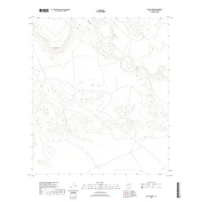
2019 Map of Duff Springs
USGS Topo · Published 2019About this map
Mitchell Mesa dominates the northern high ground of this West Texas landscape, where life and movement are dictated by the intermittent flow of desert water. The hydrology is anchored by Duff Springs and Davenport Spring, vital water sources that have historically supported ranching and transit through these high-elevation basins. A complex network of drainages including Goat Cr, Walnut Draw, and Duff Creek carve through the terrain, illustrating the natural conduits for seasonal runoff. To the south, a feature simply labeled The Ditch suggests man-made modifications to the natural drainage, likely intended to manage water for livestock or local agriculture. The presence of Cottonwood Spring near Dark Canyon further highlights the rare and critical water points that define the survival and settlement patterns of this Brewster County region.
Find a feature on this map
10 named features on this map. Tap any name to fly to it.
Don’t see what you’re looking for? This feature index may not catch every label — zoom into the map to look around manually.
Map Details
Editions of this 2019 Duff Springs Map
This is the sole edition of this map. No revisions or reprints were ever made.
Other maps of this area

1895 · Alpine
USGS Topo · 1:125,000

1917 · Buck Hill
USGS Topo · 1:62,500

1918 · Buck Hill
USGS Topo · 1:62,500

1918 · Jordan Gap
USGS Topo · 1:62,500

1925 · Buck Hill
USGS Topo · 1:62,500

1930 · Jordan Gap
USGS Topo · 1:62,500

1954 · Fort Stockton
USGS Topo · 1:250,000

1958 · Fort Stockton
USGS Topo · 1:250,000

1959 · Emory Peak
USGS Topo · 1:250,000

1965 · Emory Peak
USGS Topo · 1:250,000