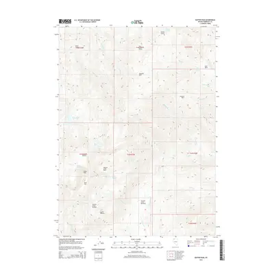
2015 Map of Duffer Peak
USGS Topo · Published 2015About this map
Duffer Peak and the high elevations of the Pine Forest Range define this high-altitude landscape in Humboldt County. This 2015 digital survey illustrates a complex network of alpine basins and meadows that collect the snowmelt feeding into the surrounding desert. Notable features include Leonard Creek Basin and the Leonard Creek Meadows, while several named reservoirs and natural lakes like Onion Valley Reservoir and Blue Lake sit tucked within the mountain folds. These water sources were vital for the seasonal livestock grazing indicated by labels such as Corral Meadow and Alder Creek Meadow. The map provides a precise look at the hydrology of the range, tracing headwaters for Big Cr, Leonard Cr, and Willow Cr as they descend through rugged gaps like Bare Pass.
Find a feature on this map
41 named features on this map. Tap any name to fly to it.
Don’t see what you’re looking for? This feature index may not catch every label — zoom into the map to look around manually.
Map Details
Editions of this 2015 Duffer Peak Map
This is the sole edition of this map. No revisions or reprints were ever made.
Other maps of this area

1886 · Disaster
USGS Topo · 1:250,000

1893 · Disaster
USGS Topo · 1:250,000

1954 · Vya
USGS Topo · 1:250,000

1958 · Vya
USGS Topo · 1:250,000

1962 · Vya
USGS Topo · 1:250,000

1965 · Railroad Point
USGS Topo · 1:62,500

1965 · Idaho Canyon
USGS Topo · 1:62,500

1965 · Duffer Peak
USGS Topo · 1:62,500

1966 · Denio
USGS Topo · 1:62,500

1979 · Denio
USGS Topo · 1:100,000