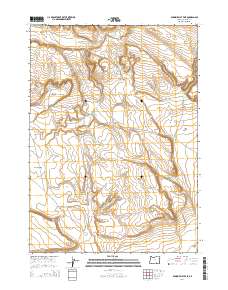
2014 Map of Duhaime Flat East
USGS Topo · Published 2014About this map
Duhaime Flat and the surrounding high desert of Harney County are defined by a collection of seasonal basins and volcanic landforms. The landscape is characterized by its flats and fields, including Tucker Flat, Desert Field, and Meadow Flat, which demonstrate the wide, level topography typical of the northern Catlow Valley region. Water management is central to the area's utility, marked by Meadow Flat Reservoir and Macs Reservoir. Transportation across this expansive terrain is anchored by Clover Swail Rd, which navigates the draws and rises near Sand Hollow and Rock Creek Point. This survey captures the rural infrastructure of the early 21st century, illustrating how ranching or grazing needs dictate the names and developments on this remote Oregon landscape.
Find a feature on this map
12 named features on this map. Tap any name to fly to it.
Don’t see what you’re looking for? This feature index may not catch every label — zoom into the map to look around manually.
Map Details
Editions of this 2014 Duhaime Flat East Map
This is the sole edition of this map. No revisions or reprints were ever made.
Other maps of this area

1955 · Adel
USGS Topo · 1:250,000

1957 · Adel
USGS Topo · 1:250,000

1958 · Adel
USGS Topo · 1:250,000

1962 · Adel
USGS Topo · 1:250,000

1971 · Duhaime Flat East
USGS Topo · 1:24,000

1971 · Clover Swale
USGS Topo · 1:24,000
1971 · Keg Sprs Valley East
USGS Topo · 1:24,000

1971 · Butler Hill
USGS Topo · 1:24,000
1971 · Duhaime Flat West
USGS Topo · 1:24,000
1971 · Keg Sprs Valley West
USGS Topo · 1:24,000